2020 National Building Code of Canada seismic hazard maps
2020 seismic hazard maps of Canada show the level of seismic hazard and an indication of the direction and steepness of the hazard gradient across the country. Note that the colour scale is adjusted from map to map in order to show national variations in a sensible way. It is not intended that values be read off these maps (hence their small scale). Instead, values for individual sites can be determined from the 2020 National Building Code of Canada seismic hazard tool. Maps of spectral (Sa(T), where T is the period in seconds) and peak ground acceleration (PGA) values are given in units of g (9.81 m/s2). The map of peak ground velocity (PGV) is given in m/s.
The NBC 2020 code and commentary requires seismic hazard values for 11 intensity measures and 3 probabilities for either a site designation of XV (Vs30 in the range of 140 - 3000 m/s) or for XS (Site Classes E-A). Below, we provide a representative suite of maps for a site designation of X450 (i.e., for a Vs30 of 450 m/s) at a probability of 2% in 50 years. As given in the seismic hazard tool, the mapped values are sensitive to the site's designation (Vs30 or Site Class) and probability.
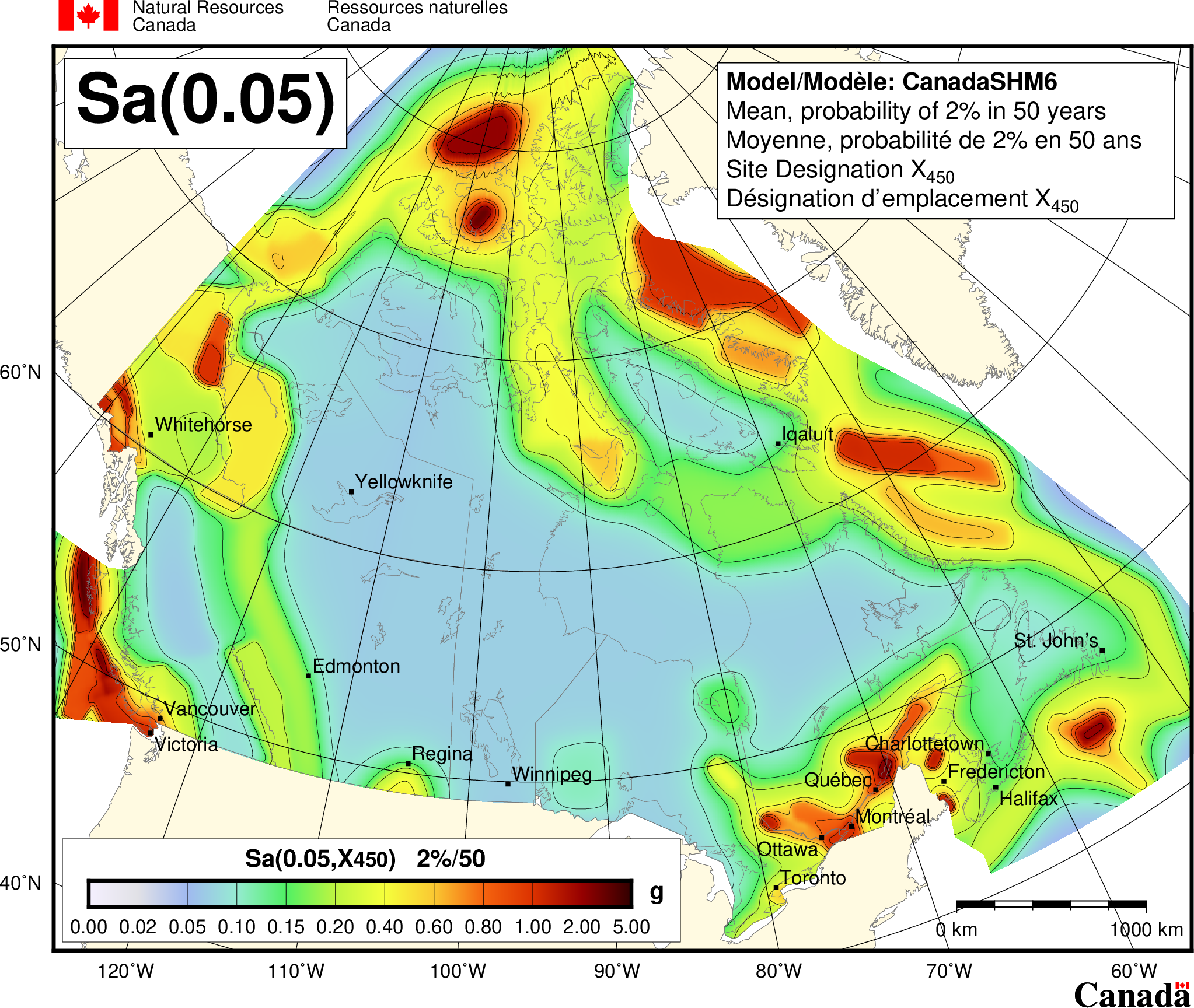
Spectral Acceleration map for a period of 0.05 seconds for Canada. Mean values of 5% damped spectral acceleration for Site Designation X450 and a probability of 2%/50 years. Spectral acceleration is contoured in g.
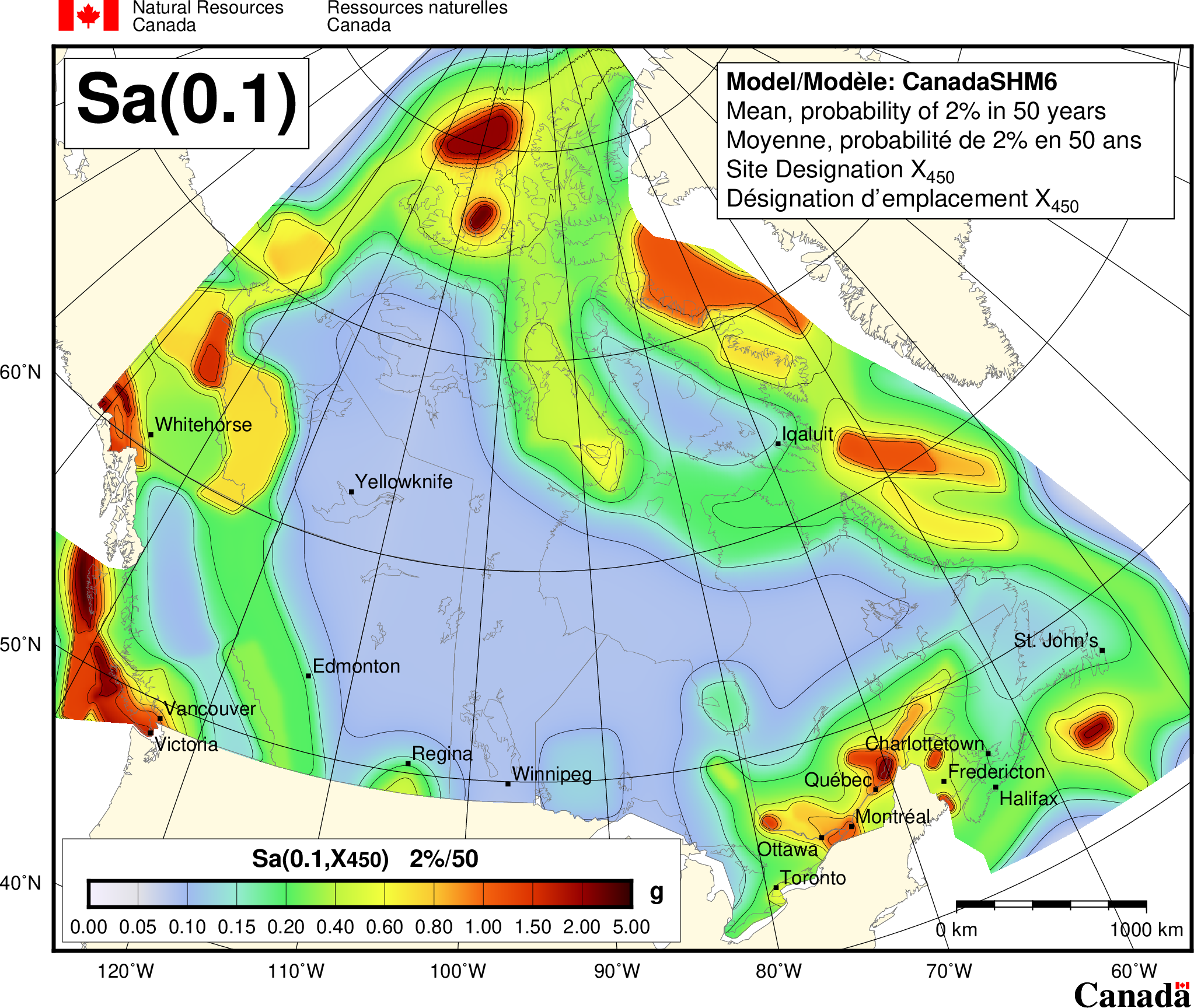
Spectral Acceleration map for a period of 0.1 seconds for Canada. Mean values of 5% damped spectral acceleration for Site Designation X450 and a probability of 2%/50 years. Spectral acceleration is contoured in g.
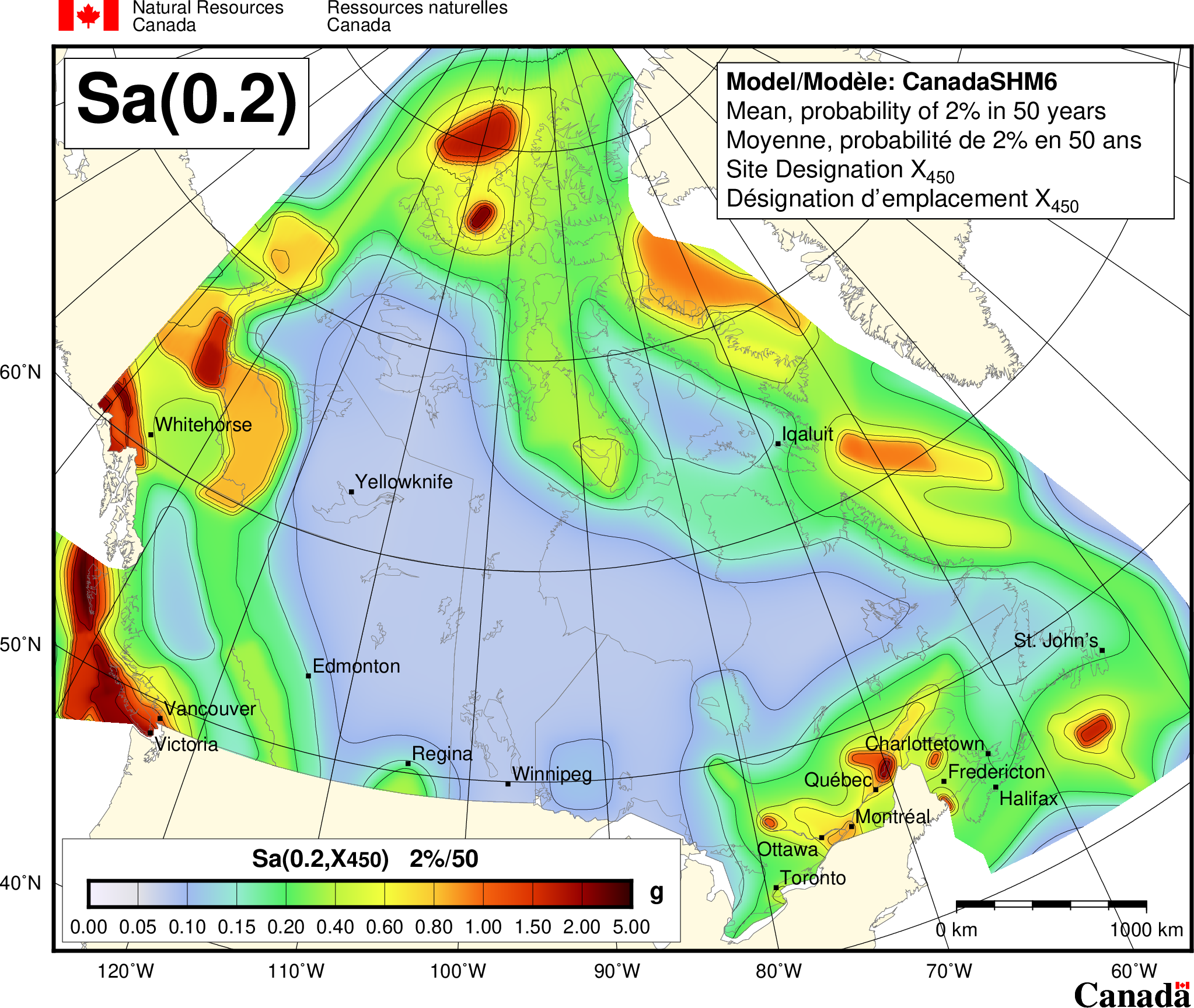
Spectral Acceleration map for a period of 0.2 seconds for Canada. Mean values of 5% damped spectral acceleration for Site Designation X450 and a probability of 2%/50 years. Spectral acceleration is contoured in g.
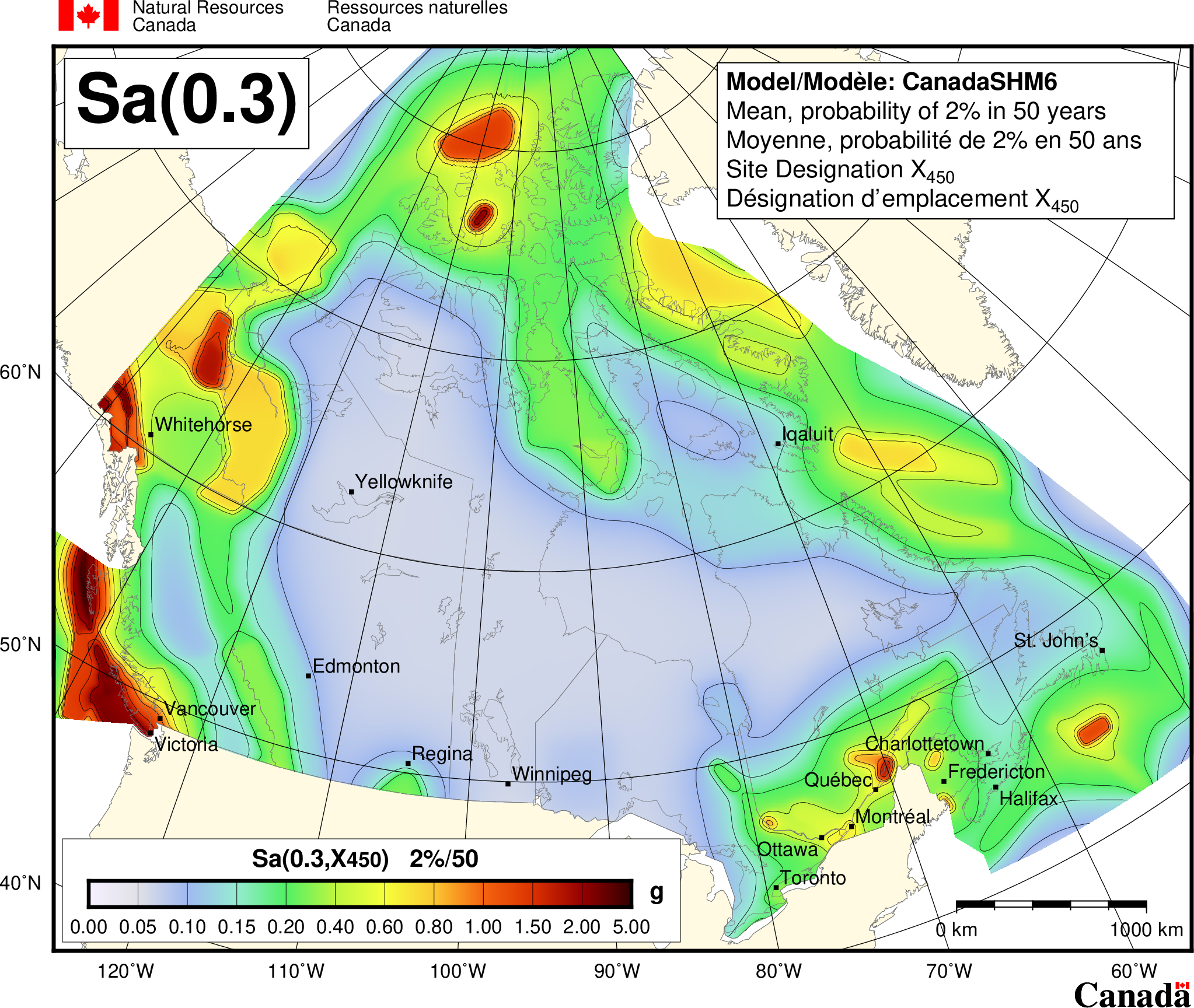
Spectral Acceleration map for a period of 0.3 seconds for Canada. Mean values of 5% damped spectral acceleration for Site Designation X450 and a probability of 2%/50 years. Spectral acceleration is contoured in g.
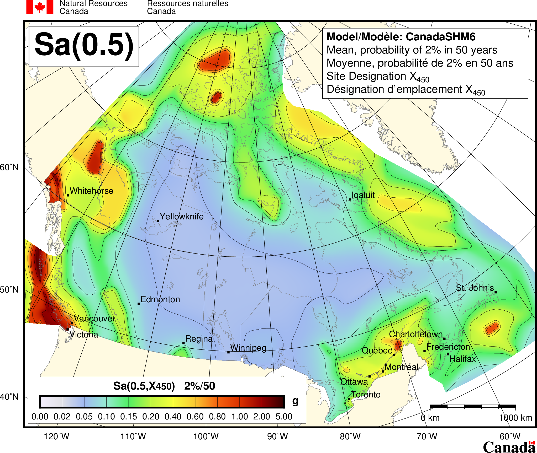
Spectral Acceleration map for a period of 0.5 seconds for Canada. Mean values of 5% damped spectral acceleration for Site Designation X450 and a probability of 2%/50 years. Spectral acceleration is contoured in g.
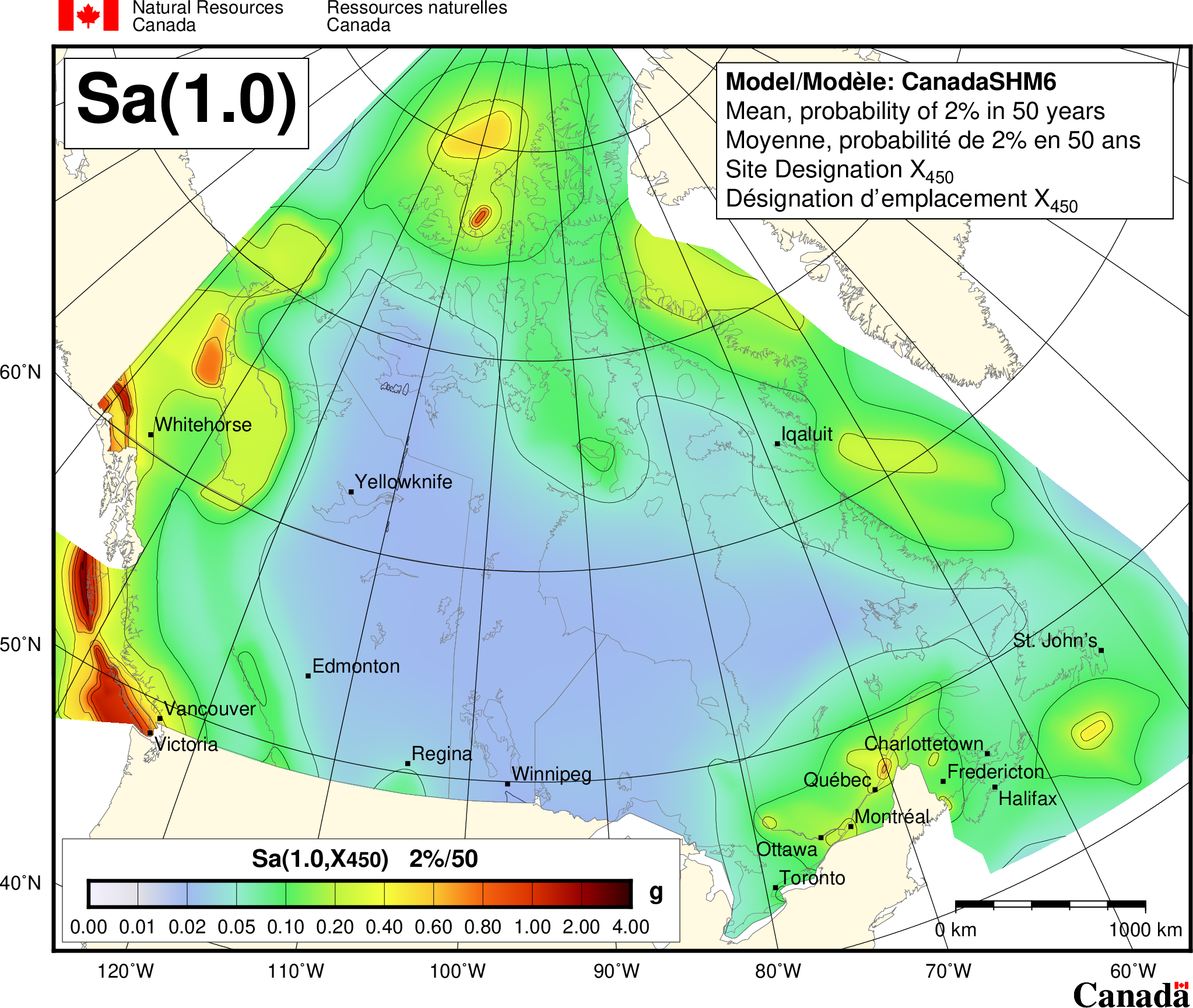
Spectral Acceleration map for a period of 1.0 seconds for Canada. Mean values of 5% damped spectral acceleration for Site Designation X450 and a probability of 2%/50 years. Spectral acceleration is contoured in g.
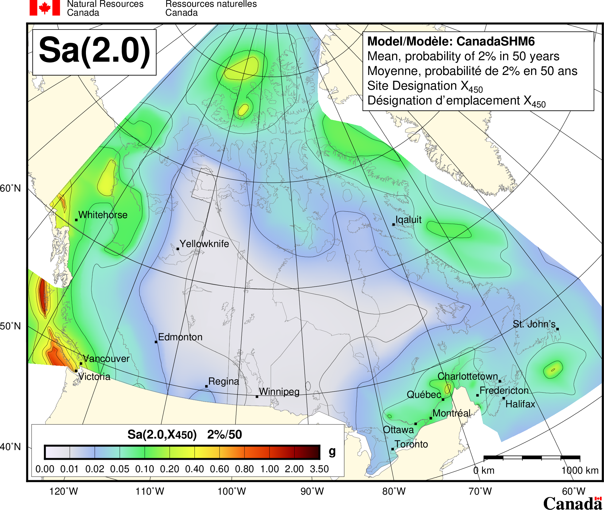
Spectral Acceleration map for a period of 2.0 seconds for Canada. Mean values of 5% damped spectral acceleration for Site Designation X450 and a probability of 2%/50 years. Spectral acceleration is contoured in g.
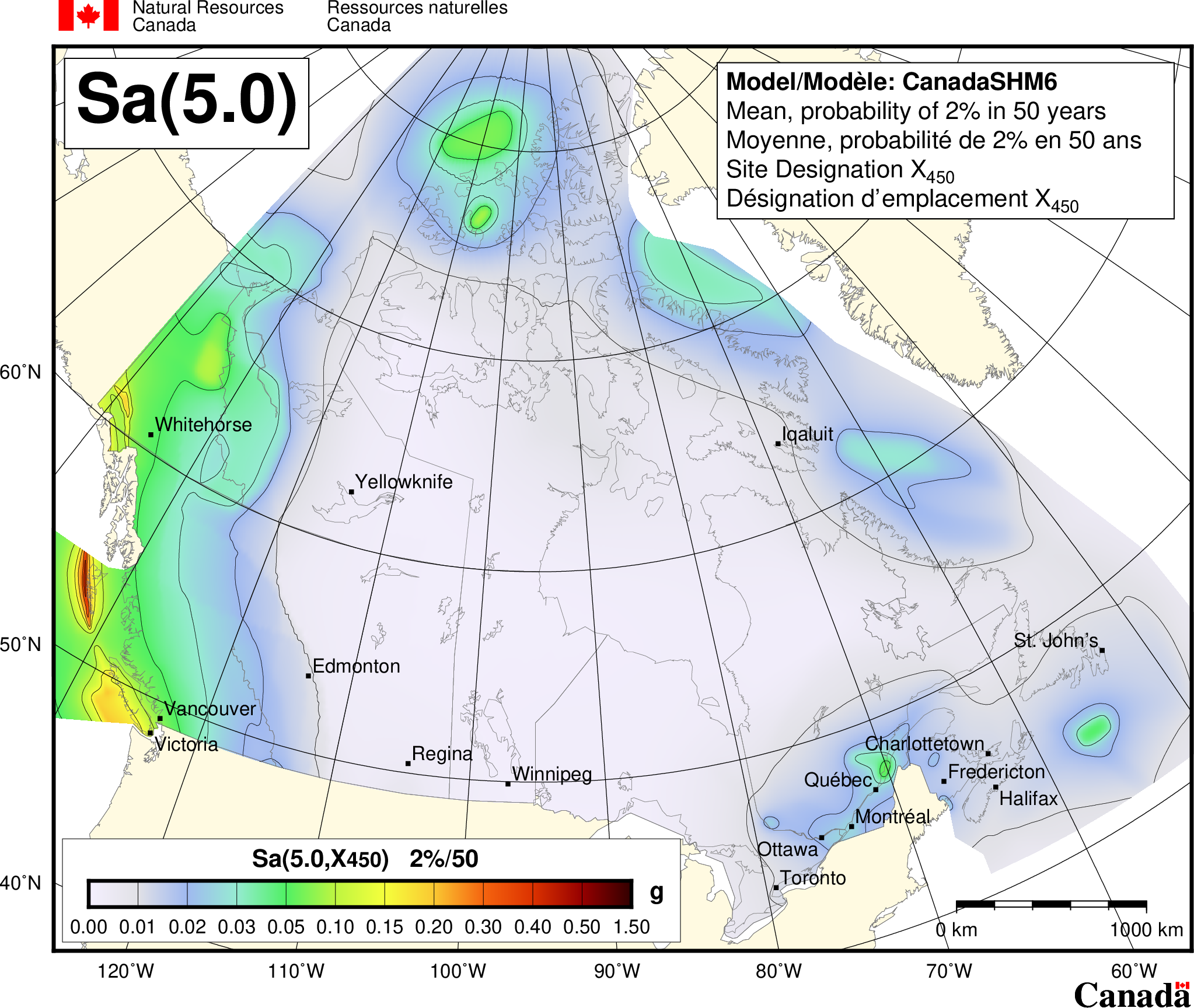
Spectral Acceleration map for a period of 5.0 seconds for Canada. Mean values of 5% damped spectral acceleration for Site Designation X450 and a probability of 2%/50 years. Spectral acceleration is contoured in g.
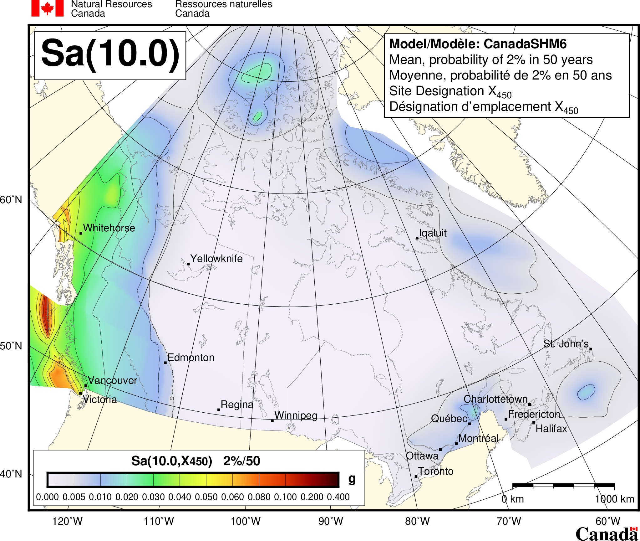
Spectral Acceleration map for a period of 10.0 seconds for Canada. Mean values of 5% damped spectral acceleration for Site Designation X450 and a probability of 2%/50 years. Spectral acceleration is contoured in g.
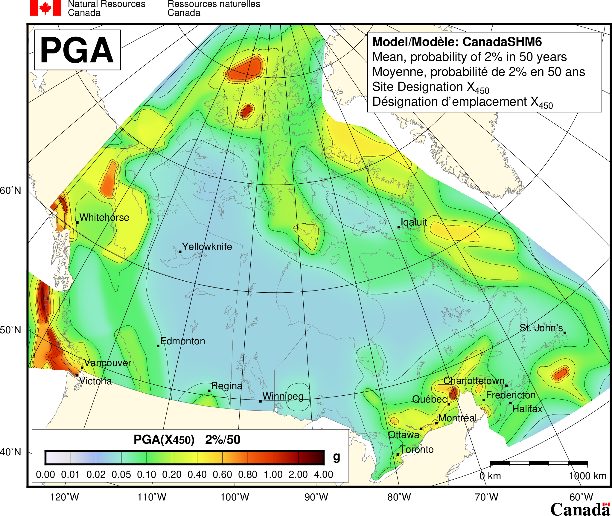
Peak ground acceleration (PGA) map for Canada. Mean values of 5% damped peak acceleration for Site Designation X450 and a probability of 2%/50 years. Peak acceleration is contoured in g.
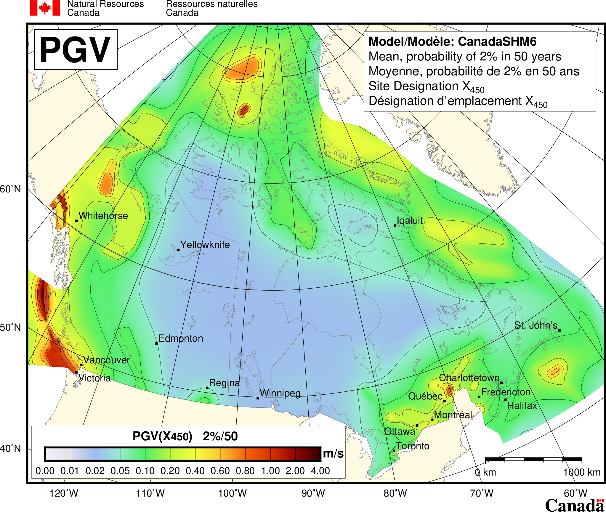
Peak ground velocity (PGV) map for Canada. Mean values of 5% damped peak velocity for Site Designation X450 and a probability of 2%/50 years. Peak velocity is contoured in m/s.