
Earthquake Early Warning - Blog
2021-10-21: Pre-ShakeOut 3 - ShakeOut earthquake drill

Today Canada joins millions of people around the world in the annual ShakeOut earthquake drill. By practicing the safest response to earthquake shaking or the receipt of an Earthquake Early Warning alert, you will create muscle memory that should take you to a safe space during an earthquake. If you don’t manage to do practice Drop, Cover, and Hold on today, you can do it any time – at work and at home.
2021-10-18: Pre-ShakeOut 2 - How to respond if you are outside during an earthquake
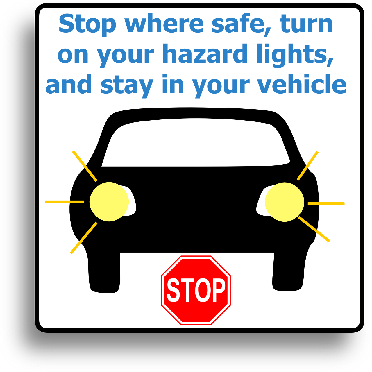
If you are outside during an earthquake or when you receive an Earthquake Early Warning alert, move to a safe space, away from old, masonry buildings or those with a lot of glass, then Drop to the ground and Cover your head and neck with your arms. If you are driving, Slow down, Pull over somewhere safe (away from older buildings and overpasses), turn on your hazard lights, and Stay inside your vehicle until the shaking has stopped. In both situations, watch for hazards, such as downed electrical lines and building components which look damaged or otherwise unsafe.
See other ShakeOut Fact Sheets
for how to respond in a variety of situations.
2021-10-12: Pre-ShakeOut 1 - How to respond if you are inside during an earthquake
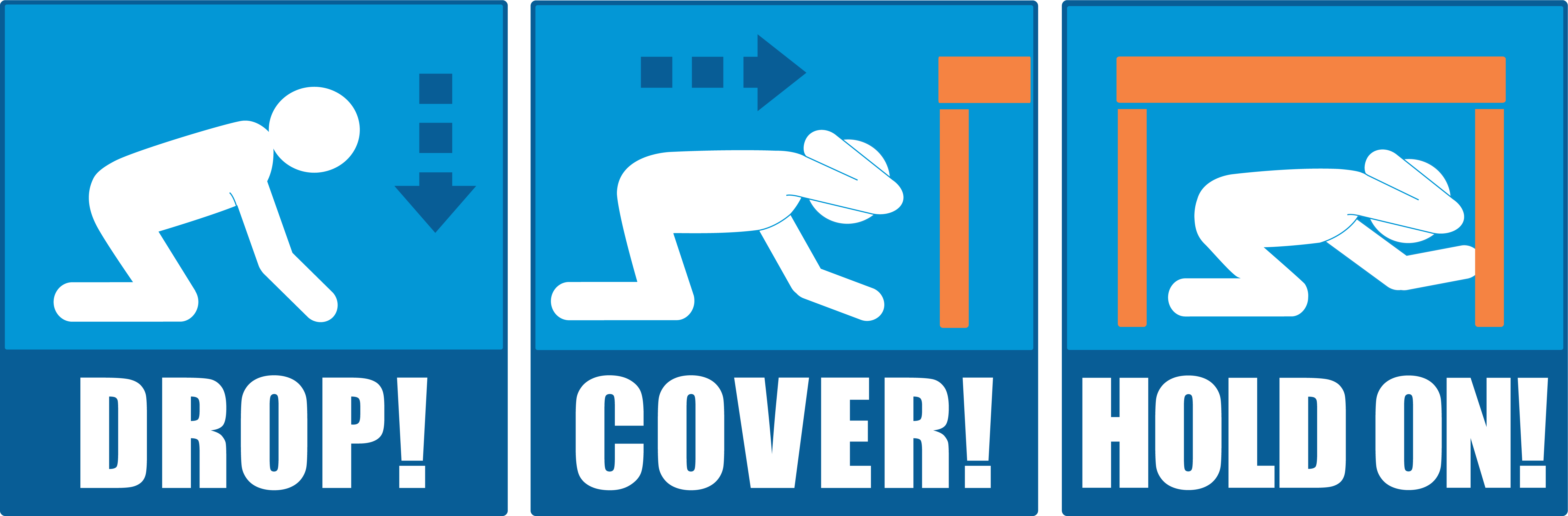
If you are inside and feel strong shaking or receive an Earthquake Early Warning alert:
- Drop to the floor, before the earthquake causes you to fall;
- Take Cover under a piece of sturdy furniture, such as a table, desk or chair; if you cannot take cover in the room you are in, move to an interior corner (away from windows, exterior walls, or other hazards) and crouch down, covering you head and neck; and
- Hold on to whatever you are under or near.
Before an earthquake it is a good idea to walk around your home and to determine where you might shelter in each room, and practice getting into that space. By doing so, you are creating muscle memory. Brains don’t function well under stress, such as when experiencing a strong earthquake, and the instinct to run outside may take over. This is a dangerous response – while running, you are likely to fall or have objects fall on you, and, as you exit a building, you are in a hazardous area as debris tends to fall along the outsides of buildings. It is best to Drop. Cover, and Hold on until the shaking has stopped, then carefully leave your building. It is also a good idea to count while you are sheltered – the longer the shaking lasts, the bigger the earthquake’s size.
2021-10-08: Testing Earthquake Early Warning station sensors
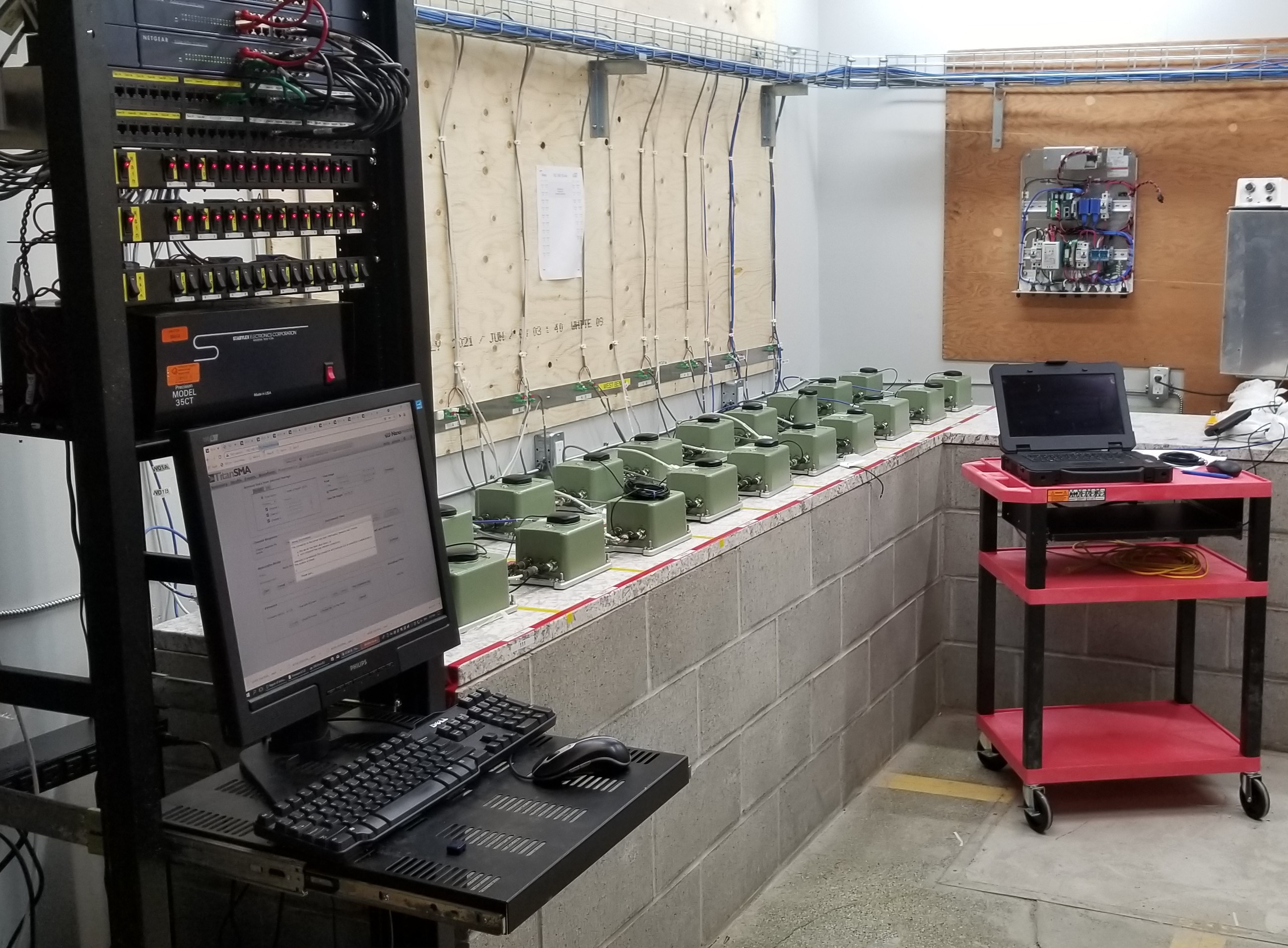
In preparation for deployment to Earthquake Early Warning (EEW) stations in western and eastern Canada, seismic equipment is first tested and calibrated in our laboratory in eastern Ottawa. Our technical team is able to set up 36 sensors at a time. All sensors are configured identically, they operate overnight, and the data are downloaded to the computer (at left) for assessment. It is key that the sensors perform nearly identically for reliable analysis of earthquakes by the EEW system. Any sensors which don’t meet our EEW performance criteria will be returned to the supplier for repair.
2021-09-07: First land agreement with major EEW host
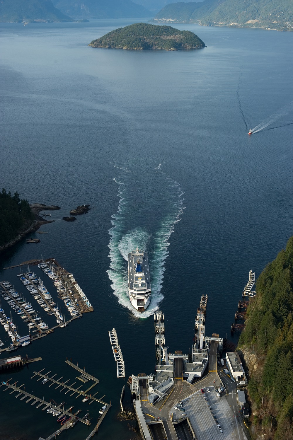
Natural Resources Canada has completed the first major land agreement for the Earthquake Early Warning network, with BC Ferries. Several BC Ferries’ terminals, critical infrastructure that Canadian’s rely on, will host EEW sensor stations. Located in key areas around the Straits of Georgia, these sites ensure the EEW network is well-distributed for optimal alerting for potentially harmful earthquakes. This agreement marks the first of several with major station hosts to ensure the success of the EEW system in Canada.
2021-08-22: Anniversary of M8.1 earthquake in Haida Gwaii (1949)
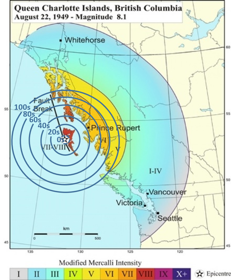
The magnitude 8.1 earthquake in 1949 was the largest instrumentally-recorded earthquake in Canadian history. It ruptured roughly 490km of the Queen Charlotte Fault (QCF), along Haida Gwaii’s west coast. The QCF is a major fault boundary between the Pacific and North American plates, similar to the San Andreas Fault in California. This earthquake caused such strong shaking that cows were knocked off their feet and most chimneys on the archipelago were toppled. One man described being thrown to the ground as he watched the fields of his farm undulate. The earthquake was felt as far away as the Rocky Mountains, southern Yukon Territory and northern Washington State.
Had Canada’s Earthquake Early Warning system been operational then, towns on Haida Gwaii would have received between 5 and 14 seconds of warning, depending on their distance from the earthquake; Queen Charlotte and Masset would have both had 9 seconds of warning (see table below). Mainland towns of Prince Rupert, Kitimat and Bella Bella would have had 43 to 91 seconds of warning.
2021-07-22: Second constract to supply EEW seismic sensors awarded to Güralp

Natural Resources Canada is pleased to announce the second contract to provide seismic sensors and installation services for the Earthquake Early Warning system, which has been issued to Güralp Systems Limited. We will soon be acquiring their Fortimus strong motion accelerograph – fittingly for Canada, it looks somewhat like a hockey puck. This device will record ground motions from potentially harmful earthquakes, then transmit the data to our processing centres from where EEW alerts will be disseminated.
2021-06-30: From the field near Jordan River, BC
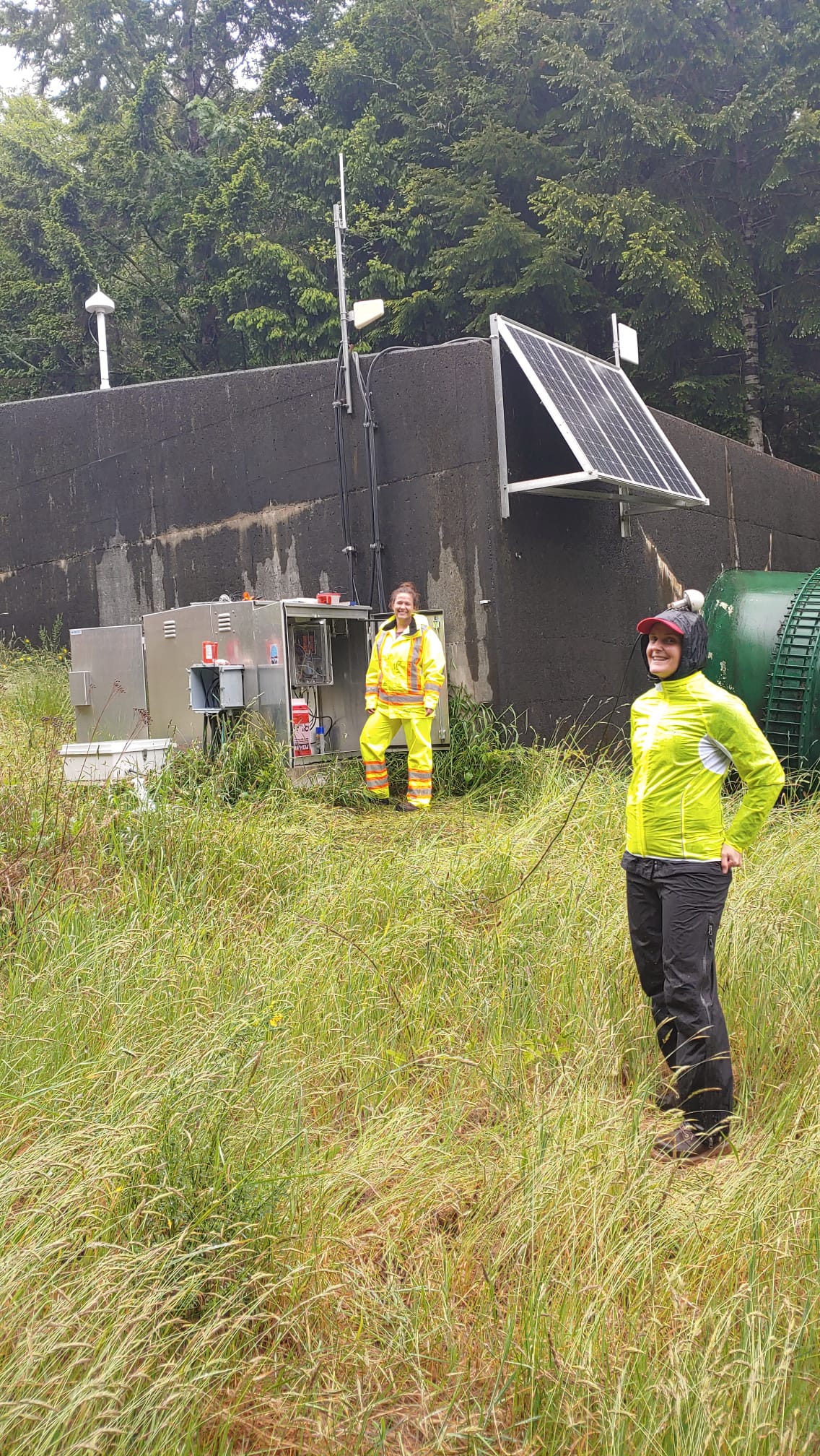
Last month, three NRCan scientists (Lisa, Camille, and Andrew) enjoyed a wet, busy, successful day in the field. Their adventures began in scenic Victoria and their travels took them through the rolling hills of Sooke before coming upon the panoramic views from the village of Jordan River. They then headed northward to NRCan’s field site, where they settled in for the day, resigned to the fact they would be drenched from rainfall before their work ended.
Their mission was three-fold. First, NRCan’s GNSS tracking station does not yet have telecommunications, so requires regular retrieval of data of exciting scientific value. With that task underway, the team was able to put full attention towards the temporary installation of a seismic sensor that will contribute to a developing community seismology project, "SchoolShake". The third task was to explore the site for installation of a sensor that would contribute to NRCan’s exciting new program to bring Earthquake Early Warning to the region.
2021-06-23: 1946 Vancouver Island Earthquake - Magnitude 7.3
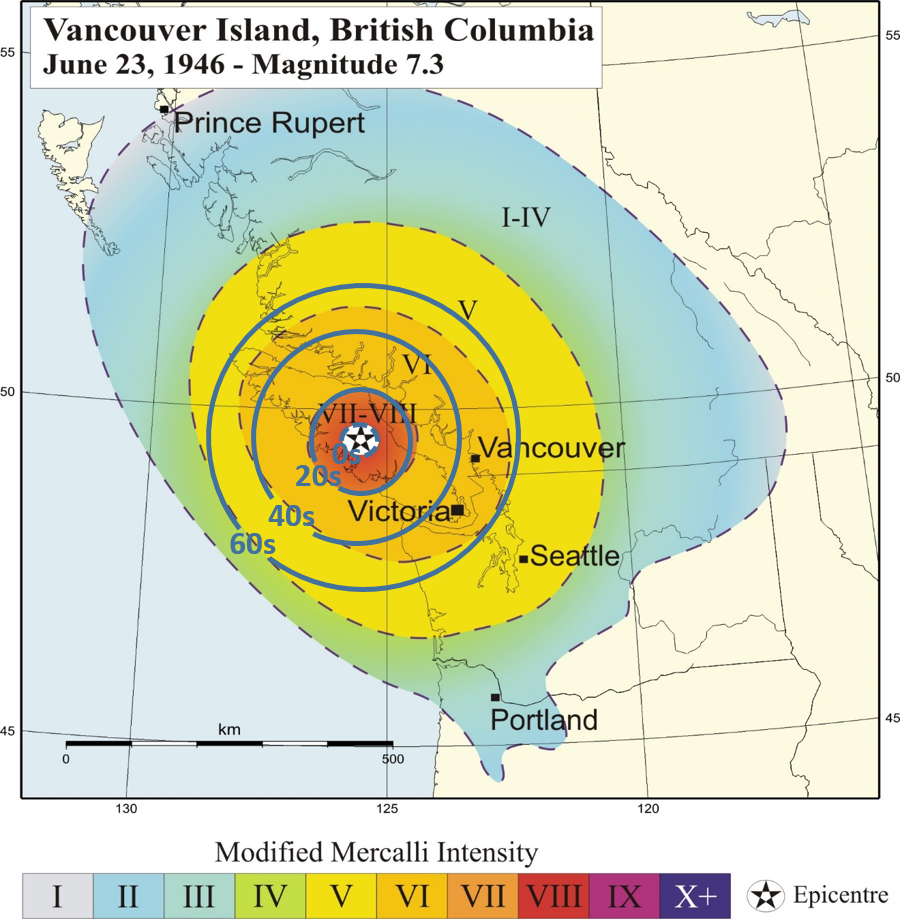
The M7.3 Vancouver Island earthquake in 1946 was the region’s largest, instrumentally recorded earthquake, causing significant damage to nearby communities. It was felt as far away as Prince Rupert B.C. and Portland, Oregon. The map of the earthquake’s intensities shows strong shaking estimated to be MMI IV was experienced in Vancouver and Victoria. Had the EEW system been operating, Vancouver would have received approximately 40 seconds of warning before strong shaking struck the city, and Victoria would have received about 50 seconds of warning (as shown in this image). Communities close to the earthquake, including Courtenay and Cumberland, would have fallen within the Late Alert Zone, extending ~30 kilometres from the epicenter (0s contour in image) and where the alert would have arrived after the strong shaking.