Earthquake Early Warning - Blog
2023-02-21: Learning from global earthquakes: Christchurch 2011
Canada suffered a number of strong, damaging earthquakes in the first half of the 20th century, but has experienced few strong events since. In order to learn about how earthquakes are likely to impact our towns and cities in these modern times, we look to major earthquakes around the world.
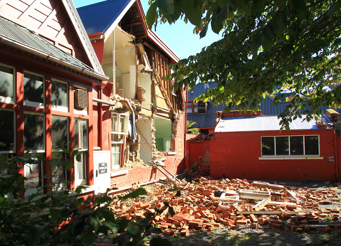

The M6.3 earthquake in Christchurch, New Zealand which occurred 12 years ago (photos, above, by Ross Becker and Brett Phibbs), for example, is a reliable proxy for what might happen to Victoria in a similar shallow, crustal earthquake very close to the city. The cities share similar geographies, populations, building codes, industries, and other characteristics. By examining the impacts of the Darfield event, we can seek ways to reduce or even eliminate similar impacts in Victoria and other cities in Canada.
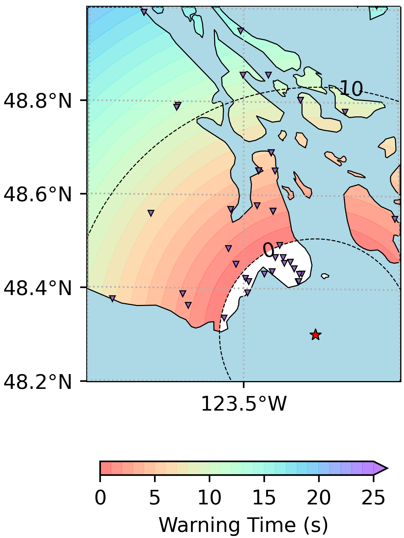
We have calculated how the Earthquake Early Warning system we are developing would behave in such an event in Victoria. Unfortunately, this is one of the rare cases of a shallow earthquake very close to a populated centre, where alerts would have very short warning times, or even arrive too late in neighbourhoods close to the epicentre (in what is known as a Late Alert Zone
, white area on the map, above). In other words, it is a good example of why it is necessary to have multiple resiliency measures in place: an EEW system, a seismically resistant building code, and public education on how to respond to earthquake shaking and EEW alerts.
2023-01-26: Anniversary of Cascadia Subduction Zone Megathrust Earthquake
On this day in 1700, the west coast of North America experienced its most recent megathrust earthquake and tsunami. The Cascadia Subduction Zone (CSZ), which extends from Vancouver Island to northern California, ruptured in a major earthquake with a magnitude around 9, causing strong shaking that would have lasted a few minutes, and triggering a tsunami which impacted the coastlines, devastating coastal villages. The Indigenous communities created a story around this event: a thunderbird and a whale fight, creating a great shaking of the earth and, in the struggle, the whale's tail strikes the ocean, causing enormous waves.
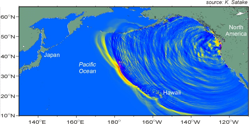
The date of the event is known because the tsunami travelled across the ocean and caused damage in Japan. Researcher Kenji Satake used the timing and heights of the waves recorded in Japan to reverse-model the event, determining it would have occurred along the CSZ around 9pm on 26th January 1700. Not only does this fit with the Indigenous accounts of the event happening during winter, just after they had gone to bed, but the year is corroborated with carbon and tree-ring dating of trees which had been submerged in seawater due to the coast subsiding, and in turbidite deposits along the coast (Goldfinger).
Once the EEW system is operational and the CSZ next ruptures, people in Tofino will have up to 237 seconds of warning before the strongest shaking begins, those in Victoria will have 4 to 213 seconds, and those in Vancouver will have 21 to 239 seconds. The range in warning times is due to the variation in possible ruptures along the CSZ.
2023-01-17: Strathcona Regional District installing EEW stations at remote sites along BC coastlines

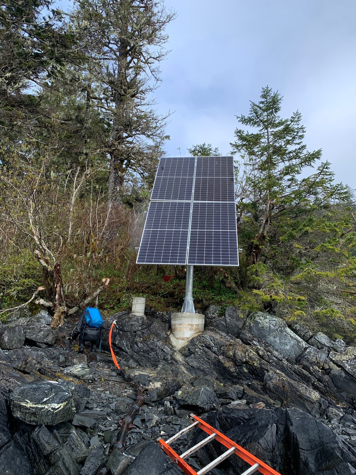
The Strathcona Regional District (SRD) through its partnership in the Connected Coast Network is installing 25 EEWS sensor stations, funded by Natural Resources Canada, at remote, coastal sites in British Columbia. All SRD's stations will use the Connected Coast's subsea fibre optic communication technology; this will improve the reliability of the EEW system, by providing a fast, alternative way to transmit data. The sites for the EEW stations were selected to strengthen and enhance the EEW system for these and neighbouring communities.
2023-01-11: Installation of 100th station in national EEW network

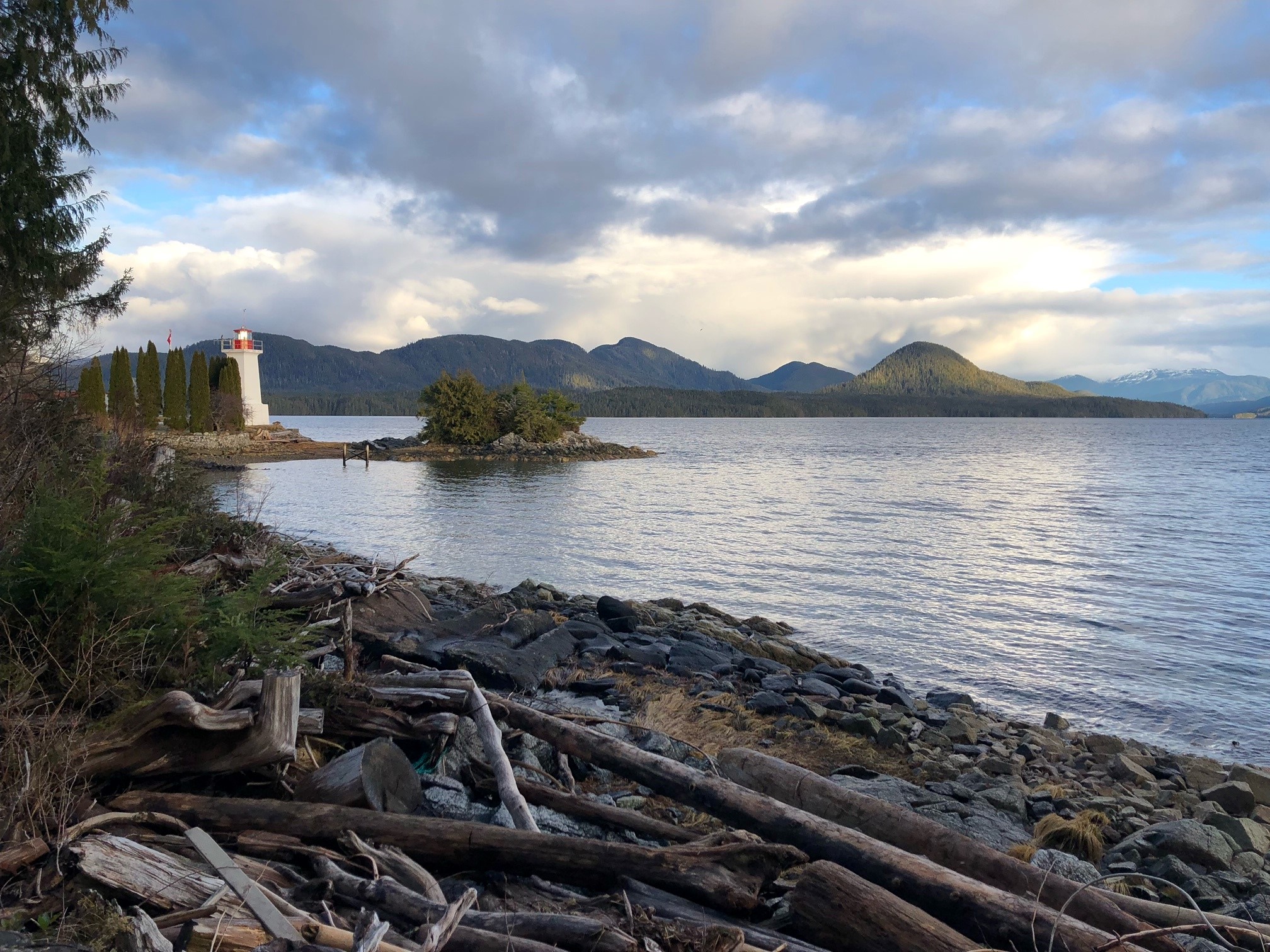
On Saturday, we reached the exciting milestone of 100 stations installed in the national Earthquake Early Warning (EEW) network. The 100th station was installed at Dryad Point Lightstation near Bella Bella.
Once complete, in 2024, the network will comprise of roughly 400 stations in areas of moderate-to-high earthquake risk: in western British Columbia, eastern Ontario, and southern Quebec. These are regions where there is both the threat of significant earthquakes, and concentrations of population and critical infrastructure (such as rail lines and power stations).
2022-12-08: Coastal First Nations' Great Bear Initiative installs EEW stations in their communities


Coastal First Nations - Great Bear Initiative (CFN-GBI) is installing eight Earthquake Early Warning (EEW) sensor stations, within CFN-GBI communities and at the Hakai Institute on Calvert Island, BC. So far, five stations have been installed, at Nuxalk Nation's community at Q'umk'uts' (Bella Coola), Gitxaala, Gitgaat, Metlakatla, and Hakai. The stations, funded by Natural Resources Canada, will expand the area of coverage of the national EEW system along the northern mainland coast of British Columbia, and improve alert times for the region, allowing people more time to take protective actions.
The project will also improve the communities' resilience to earthquakes, through educational efforts including how community members can protect themselves when they receive EEW alerts. This initiative is being coordinated by Patrika McEvoy (Kwaa Tsaaps), whose responsibilities include establishing suitable locations for the sensors stations within each community, acting as liaison to the communities, and installing and testing the EEW equipment. Patrika has received training from NRCan and the supplier of the earthquake sensors, Nanometrics, to enable her to do this work.
2022-11-18: Montreal earthquake and EEW late alert zones
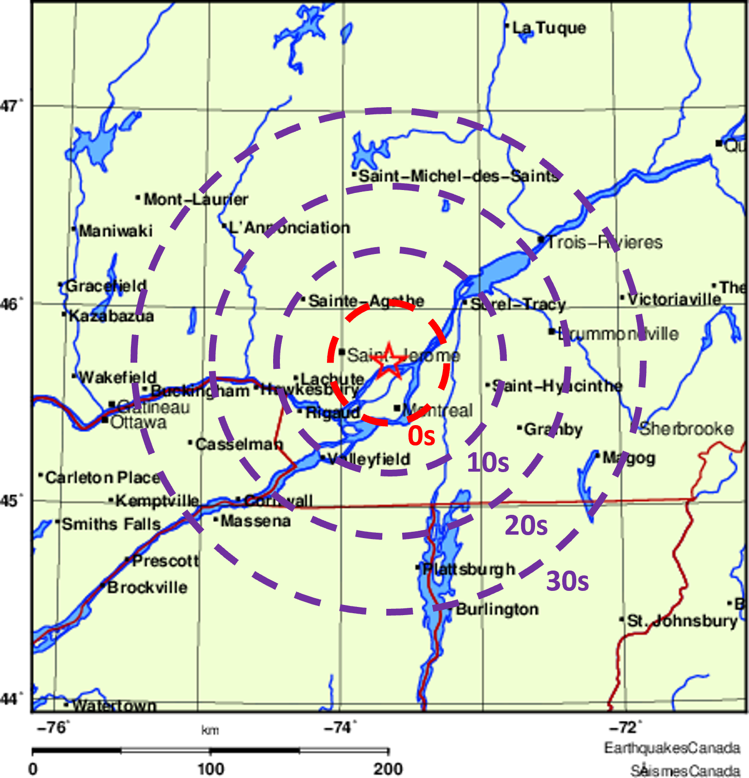
On Monday night (14th November), a magnitude 3.5 earthquake near Terrebonne, Quebec, was felt throughout the Montreal area. Although too small to cause damage, this earthquake provides an opportunity to evaluate the expected performance of the national Earthquake Early Warning system currently being installed by NRCan. Estimates of warning times show that Ottawa would receive 35 seconds of warning. The earthquake epicentre was only 26 km from central Montreal, which in this case lies within the “Late Alert Zone,” where people and facilities are too close to the epicentre to receive an alert before the strong shaking arrives.
2022-11-17: EEW showcased at Emergency Managers' conference
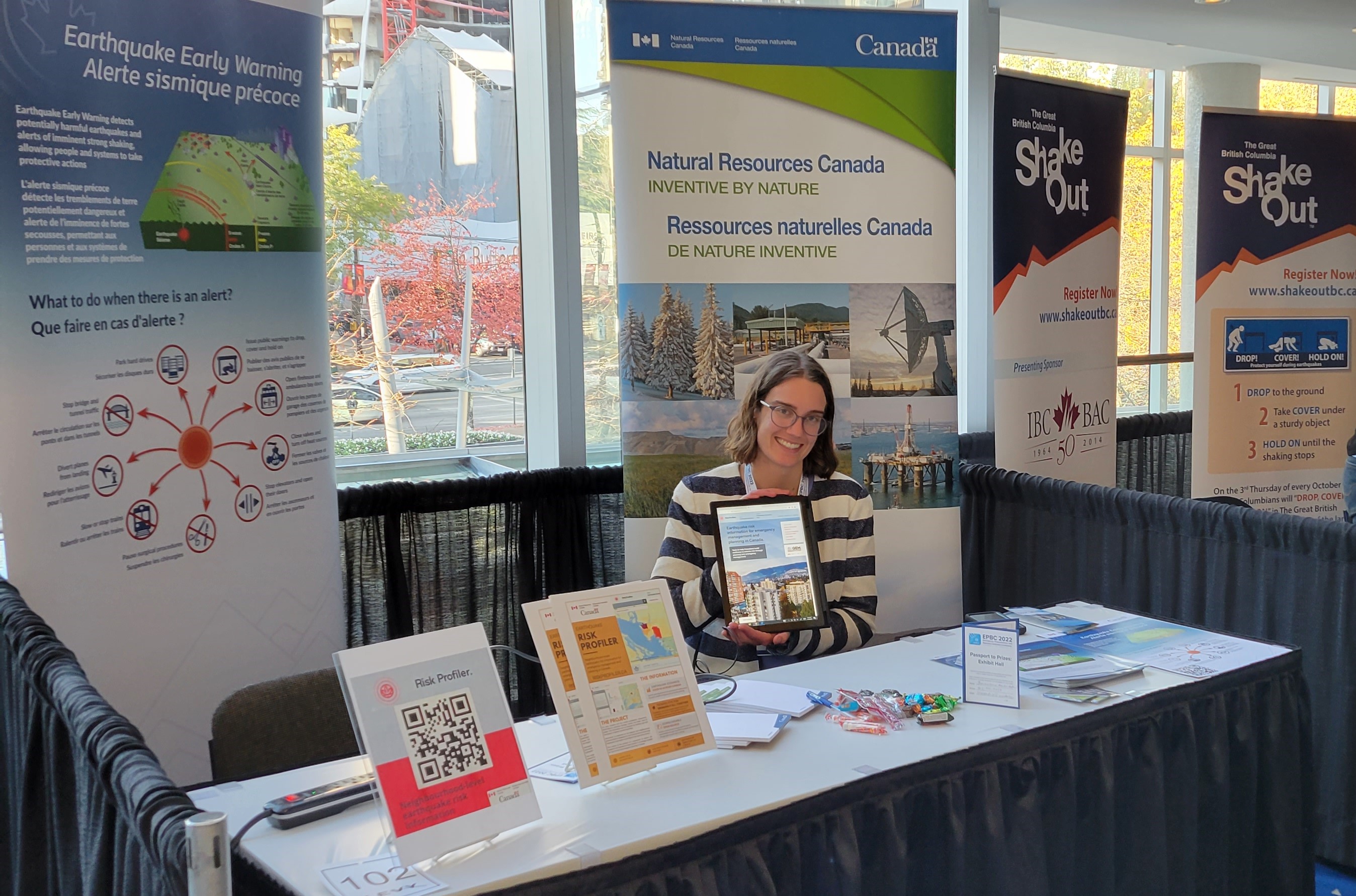
Last week, the Emergency Preparedness and Business Continuity conference was held in Vancouver, BC, and attended by over 500 emergency managers and planners, and natural hazard scientists. Natural Resources Canada's (NRCan) Alison Bird presented on the national Earthquake Early Warning (EEW) system, in development, in a session co-hosted with Emergency Management BC. The audience was excited to learn of this coming technology and how the EEW alerts could be used to reduce the impacts of earthquakes. There was considerable discussion on how the alerts could trigger devices to stop trains, open doors, and close valves, plus alert people to protect themselves. Nicky Hastings gave a plenary talk on the new Risk Profiler (RP) website, which provides earthquake risk data, including for various scenario events – useful for emergency managers and planners, plus engineers and the public. Julie Van de Valk and Cathryn Hale also hosted an NRCan booth, giving numerous attendees who visited the booth more opportunities to discuss in detail EEW and RP.
2022-10-28: 10th anniversary of M7.8 earthquake on Haida Gwaii as EEW stations come to the islands
Today marks the 10th anniversary of the magnitude 7.8 earthquake which struck the west coast of Haida Gwaii in 2012. The earthquake caused strong shaking across the islands and the adjacent mainland, thankfully resulting in only minor damage in the islands' communities, including cracked foundations and walls, a few toppled chimneys, and some broken windows.
The earthquake triggered a tsunami which struck the west coast of Haida Gwaii and reached as far as Kahalui, Hawaii. No one on Haida Gwaii witnessed the tsunami, however, as there are no communities on the islands' western coasts. Also, as the earthquake occurred in cold, rainy October, no one was travelling in the Gwaii Haanas region, popular with kayakers and campers. In the weeks that followed, NRCan researchers visited inlets where modelling had suggested waves could have been significant. They found clear evidence that waves had reach about 7m in elevation: seaweed hanging from the branches of trees (photo above left), fish on the forest floor, and logs which had been floated from their usual resting place. What has become known as Earthquake Point was scoured by the tsunami waves up to a height of approximately 13m. Debris from the Tohoku-Oki, Japan tsunami in 2011, such as fishing floats and plastic bottles, had also floated across the Pacific Ocean and been tossed onto Haida Gwaii by the 2012 tsunami. This was the world's largest tsunami that year.
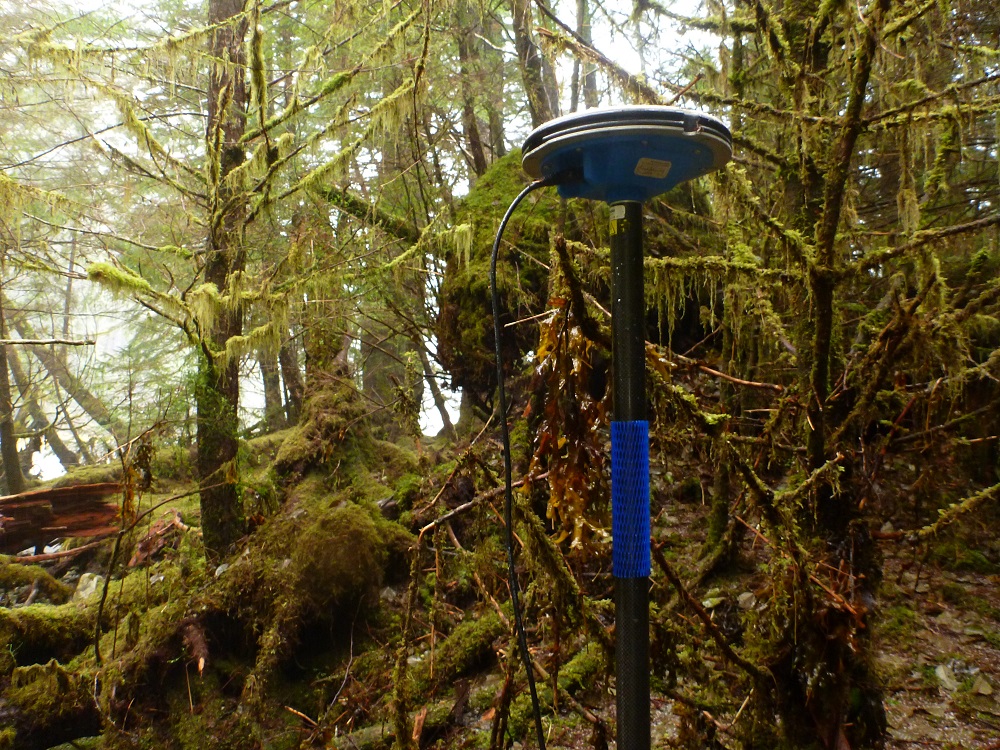
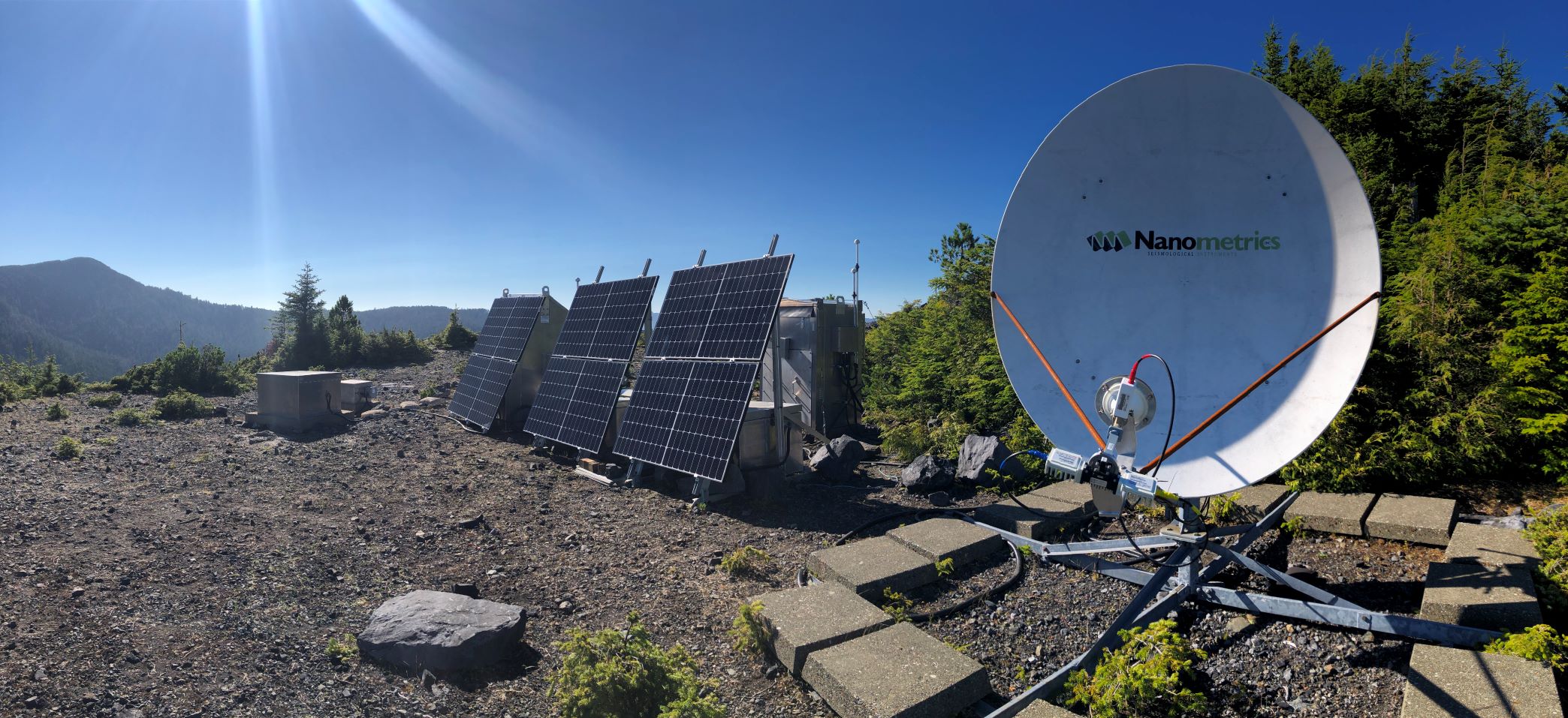
As we mark the anniversary of this event, NRCan has been installing Earthquake Early Warning stations on Haida Gwaii (photo above right), within the islands' communities and at several other locations. One station is on Hotspring Island, where the hot springs stopped flowing as a result of the 2012 earthquake; they have recently reappeared, to the delight of visitors to the island. Another station is at Cape St. James, at the southern tip of the archipelago, where equipment has to be especially robust as the cape is victim to severe storms and strong winds. The stations will work together in a regional network that will warn of strong, potentially damaging earthquakes, so that people can take protective actions, in most cases to Drop, Cover, and Hold on.
2022-10-20: Canada participates in global ShakeOut earthquake drill
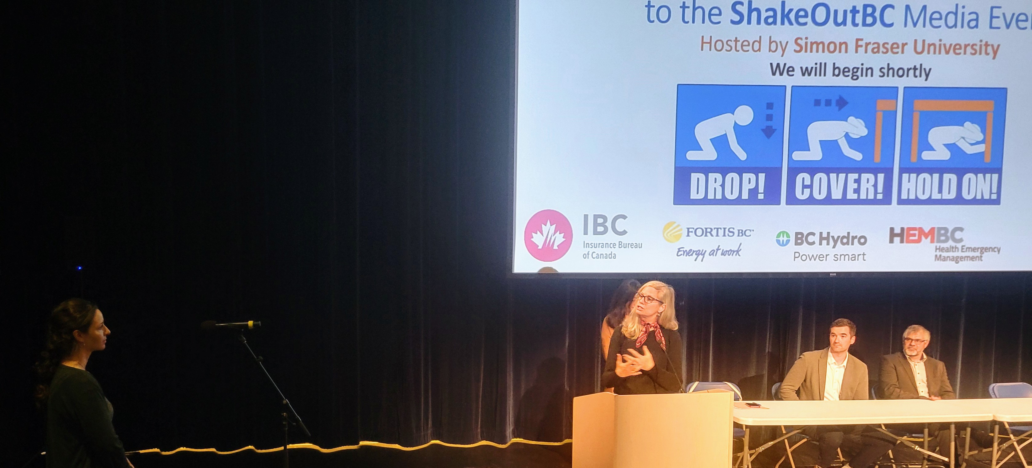
Today, nearly 700,000 people across Canada and over 45 million across the world practised the safe response to earthquakes: to Drop, Cover, and Hold on (DCHO). It is important to practise the DCHO action, so that it becomes instinctive to move to a safe location when an Earthquake Early Warning alert is received or shaking is felt.
In British Columbia, a ShakeOut event was held at Simon Fraser University's campus on Burnaby Mountain, with video participation by First Nations' communities around the province. This was preceded by a public “Ask the Experts” webinar, yesterday evening, including NRCan seismologists John Cassidy and Alison Bird.
In Quebec, short videos have been produced to educate people of the threat of earthquakes in the province.
In the Yukon, a series of public webinars was held, on earthquakes and the various ways to prepare for the natural hazards which impact the territory.